TasNetworks is seeking your feedback to help shape a proposed community benefits sharing program (CBSP) for the North West Transmission Developments (NWTD). Have your say here.
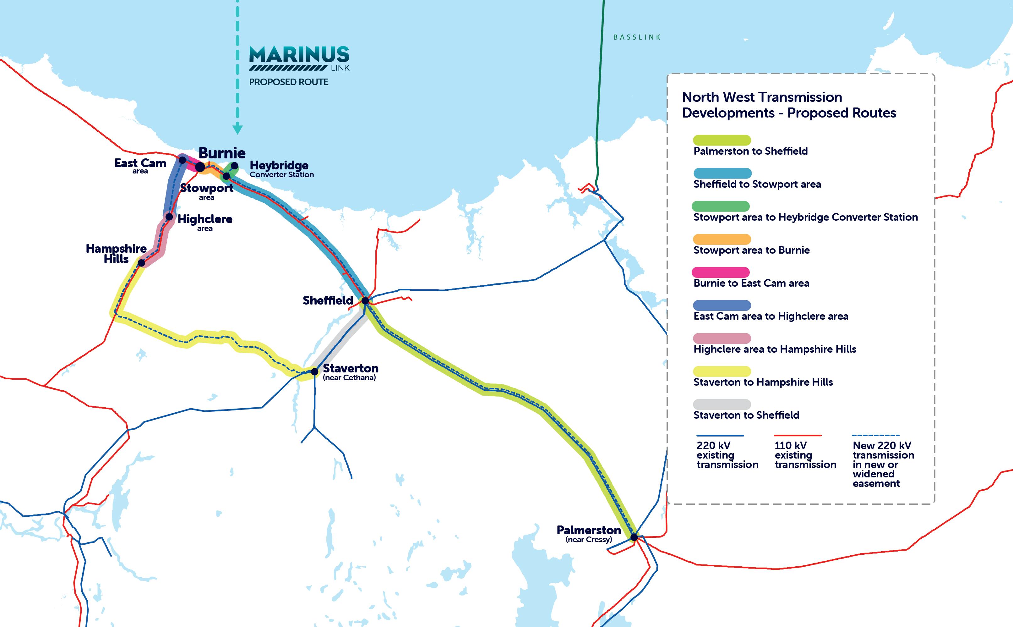
The Staverton to Hampshire Hills proposed transmission line is an important link in TasNetworks’ North West Transmission Developments that will enable Tasmania to double its clean energy capability and power up investment in Tasmania’s north-west.
TasNetworks released a proposed route in November 2019, and after further desktop analysis and considering community and landowner feedback the proposed route was refined with a preferred route identified and released in August 2020.
As part of the environment, planning and heritage assessment process, TasNetworks undertook studies along the preferred route to understand any potential impacts the project may have on the environment and local communities. The field surveys identified some significant geological and ecological features.
Specifically, the results of the field studies and geotechnical drilling have shown that a section of the transmission line, around 10km, is located on land that is prone to landslides, could result in impacts to the karst and cave systems as well as areas of native rainforest.
Based on these findings, it is necessary to realign a section of the preferred route further to the south to avoid these areas.
TasNetworks acknowledges that realigning this section of the transmission line will bring the line closer to a small number of additional properties and will be working closely with these landowners to understand any concerns that arise and examine ways to minimise impacts.
Further field studies along the revised route will be required to inform and finalise the environmental, planning and heritage assessment process. The studies will commence in December 2021 and take up to six months to complete.
The landscape and visual impact assessment for Staverton to Hampshire Hills will help us to assess the impact of new overhead transmission lines on the local landscape, and the visual amenity on residents and visitors.
The extent of any change and its impact on views can vary according to the values of residents and visitors. In September 2020, we asked the communities of Loongana, Nietta, Erriba and Staverton, and surrounds, to provide feedback on their local landscape values to help with this assessment.
Initial feedback showed a strong connection to the landscape, a familiarity with the landscape setting and appreciation of the changes in the character of the landscape that contribute to the local sense of place. But we also heard that locals found it difficult to imagine what the transmission lines would look like. To help with this, we have prepared geo-spatially accurate photomontages from the prominent and frequented viewpoints identified by residents and visitors as important.
The photomontages aim to illustrate the scale and form of the proposed new assets at the following locations:
You will find four images for each location. The first shows the landscape without any assets; the second shows overhead transmission lines in the landscape immediately after construction, when the galvanised steel is most shiny and the cleared easement void of regrowth. The third image shows these assets circles to identify better where they are located. And the fourth shows the overhead transmission lines in the landscape 2 to 5 years post construction, when the towers have weathered and some vegetation has grown back in the easement.
After considering landowner, neighbour and community feedback, TasNetworks has released a revised route for the Staverton to Hampshire Hills section of the North West Transmission Developments. This is referred to as the ‘preferred’ route.
For more information on the route selection process, see:
Over the coming weeks, we would like to meet with you to present the preferred route and details of our route selection process, including how we incorporated feedback in our investigations, and to outline the next stage of the process, including the visual impact assessment ans field survey work.
Ensure you sign up to our e-newsletters to stay up to date on our future engagement activities.
You can contact us with any question about the proposed developments to the North West Tasmania transmission network via our project email and phone line. If you would like to find out more, you can also visit the TasNetworks website, email us on team@marinuslink.com.au , or call us on 1300 127 777.


